This new Socio-Economic Atlas of the Lao PDR provides readers with a highly detailed, multidimensional set of insights into geographic and temporal patterns of the demographic, social, and economic characteristics of the population of the Lao PDR. It combines statistical data from the last two Population and Housing Censuses of 2005 and 2015 with detailed geographic information to present a wealth of new information on a large set of highly detailed thematic maps that are accompanied with descriptive texts.
Download full atlas
00 ToC and Prefaces
01 Introduction
02 Demography
03 Migration
04 Literacy and education
05 Health
06 Ethnicity
07 Economic activities
08 Living conditions
09 Poverty
10 References
This new atlas was co-developed by the Ministry of Agriculture and Forestry (MAF) and the Centre for Development and Environment (CDE) of the University of Bern. It combines statistical data from the last two agriculture censuses with detailed geographic information to presents a wealth of new sector-specific information on a large set of highly detailed thematic maps. Not only does the atlas provide new insights into the current socio-economic and agricultural patterns in the country: It also reveals the dynamics over space and time within the decade-long inter-census period, at village-level and for the whole of the Lao PDR
Download full atlas
1 About the Atlas
2 National context
3 Introduction
4 Agricultural overview
5 Crops – annual
6 Crops – perennial
7 Livestock
8 References
The Atlas presents a comprehensiveset of maps on a wide range of socio-economicaspects of the population of the Lao PDR. For the first time, data from the National Population and Housing Census of 2005 have been mapped with a high degree ofspatial disaggregation.
Live version: https://www.decide.k4d.la/atlas05
Download summary
Download full document
Questionaires for agricultural and tree-plantation subsector
Questionaires for mining subsector
This manual outlines how to calculate the score for each indicator used for rating the quality of investment (QI), this manual also presents data sources used in the assessment, interpretation of each analyzed score, and possibility to apply these results of QI in the Government agencies’ management, monitoring works and relevant strategic planning at central and local level. The results demonstrated in this manual is analyzed from a total of 296 land deals (90 agriculture, 89 tree plantation, and 117 mining deals) which conducted in nine provinces: Oudomxay, Luang Prabang, Xiengkhouang, Vientiane, Khammouane, Savannakhet, Salavance, Sekong and Attapeu during 2014-2017. The assessment of Quality of Investment (QI) in land concession and lease in Laos is a cooperation between Ministry of Planning and Investment, Ministry of Agriculture and Forestry, Ministry of Energy and Mines and Ministry of Natural Resources and Environment under the Lao DECIDE info project phase III.
Download full document
Integrating customary land and resource use patterns of local and indigenous communities into protected area planning is of crucial importance in a country like Laos, where livelihoods of rural populations are still very much intertwined with their natural environment. The newly established Hin Nam No National Park in central Laos overlaps with the traditional village lands of its 19 multi-ethnic guardian villages located in direct vicinity around the park border. This report presents a participatory approach tested in two of the villages that sought to explore how zoning and use regulations of the park could be reshaped in order to become more inclusive towards people’s livelihood needs.
Download full document
The State of Land in the Mekong Region is based on key data and information, largely available in the public domain, to identify and describe the key issues and processes revolving around land in the Mekong Region. It aims to be a basis for constructive dialogue and collaborative decision-making.
The State of Land in the Mekong Region is structured around five domains:
(1) the land-dependent people of the Mekong
(2) the land resource base
(3) the distribution of land
(4) the land tenure security
(5) the land governance.
One of the conclusions concerns the increase in the inequality in land distribution, with a reduction of small holders land holdings size on one side, and with a large proportion of agricultural land given in concessions, resulting in a boom in commodity/ export crops.
Another striking feature is that contrary to common wisdom, farmers remain the majority of population in all countries except Thailand. The agrarian transition is on its way, but far from complete. Rural to rural migrations are higher than rural to urban ones. The creation of employment in secondary and tertiary sector is not sufficient to absorb the work force coming out of agriculture. This also results in growing cross country migrations. This means the demand for agricultural land is increasing, and explains some of the drive of farmers towards upland areas.
Download full document
This report presents the main results from a poverty mapping analysis of Laos based on the 2012/13 LECS-5 survey and the 2015 Population and Housing Census. Monetary and non-monetary poverty indicators are presented at two different administrative levels: province and district. The non-monetary poverty indicators – closely related to the SDGs – were easily calculated directly from the Census databases. The monetary poverty indicators are based on a statistical methodology using survey and Census data to estimate poverty rates and other monetary poverty indicators at local levels.
The results show that for most indicators there is a relatively high level of heterogeneity across provinces and districts, raising the possibility of more efficient geographical targeting. Furthermore, the low correlations among the different indicators implies that policy makers need to have indicators specific to different objectives. A one-size-fits-all indicator does not yield efficient outcomes for any intervention.
Download full document
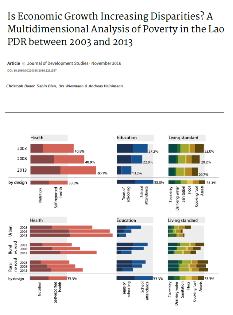
The Asian story of miraculous growth and poverty reduction has reinforced mainstream views of development that equate high and sustained economic growth with progress in human wellbeing. But understanding development only in terms of economic growth is not sufficient. This paper offers a different perspective on possible effects of Laos’s transition from a subsistence-oriented economy to a market-oriented economy. We used a multidimensional poverty approach with panel data for the years between 2003 and 2013. Findings suggest that benefits were not equally distributed: 50 per cent of people moved in and out of poverty, and the other half was either non-poor (37%) or always poor (13%).
Download full document
This publication provides the first national overview of land concessions and leases in the Lao PDR. It was initiated in response to the rapid expansion of land deals and the corresponding demand for a data-driven assessment on a national scale. The analysis is based on a government database on land investment and includes both statistical and spatially referenced data, in combination with a range of socioeconomic and biophysical variables. This publication gives insight into key issues surrounding the land investment debate, and provides a valuable baseline for further research and informed, evidence-based policy making.
Download full document
The study on poverty and inequality in the Lao PDR presents highly detailed information on the spatial distribution of welfare across the country, which have been developed through the application of small-area estimation techniques combining information from the 2003 Lao Expenditure and Consumption Survey and from the 2005 Population and Housing Census.
Download full document
The Government of Laos (GoL) strongly promotes commercial investments in land (CILs) as a component of the national development strategy. However, the land use and land cover (LULC) changes caused by CILs are not adequately understood, especially pathways leading to forest and agricultural land conversion. Although economic growth based on CILs is a government priority, it may conflict with other goals of forest management and conservation, national food security, expansion of commercial agricultural, energy production, and rural development.
Appropriate and accurate LULC change information systems, including data collection and analysis, is important to support decision-making for policy makers in balancing numerous government objectives. Presently, as many potential CILs are at the prospecting and exploration phase, there is an urgent need for appropriate mechanisms and measures to prevent unsustainable LULC change and support successful implementation the National Master Plan on Land Allocation.
Commercial investments in land has been strongly promoted by the government as a driver for economic growth and an avenue to facilitate the rural transition from subsistence to a better and more stable income e.g. wage-based livelihood. This brief provides insights on how commercial investments live up to these claims, particularly regarding contributing to improving rural employment in the Lao PDR. Further, it provides concrete recommendations for policy and action to both decision-makers and practitioners working on the promotion of sustainable commercial agricultural investments in the Lao PDR. Download full document
Despite being a main driver for strong economic growth, the burgeoning of commercial investments in land over the last two decades has brought new development challenges, especially their adverse impacts on the local environment and livelihoods in the Lao PDR. Recently, the Lao government has called for a systematic assessment of the quality of investment to identify “good” investments and eliminate the “bad” investors. This brief presents results of the quality performance of 297 investments in the Lao PDR based on an assessment of multi-dimensional aspects of quality of investments, including environmental, economic, and social impacts as well as legal compliance. Further, it provides concrete recommendations for policy and action to both decision-makers and practitioners regarding pathways to enhance the quality of investments and balance trade-offs among different dimensions towards more sustainable outcomes.
Download full document
This brief provides concrete recommendations for policy and action to both decision–makers and practitioners working on the promotion of sustainable commercial agricultural investments in the Lao PDR. The insights presented in this brief are based on an integrated analysis of information from a recent national inventory of land concession and other national socio–economic information.
Download full document
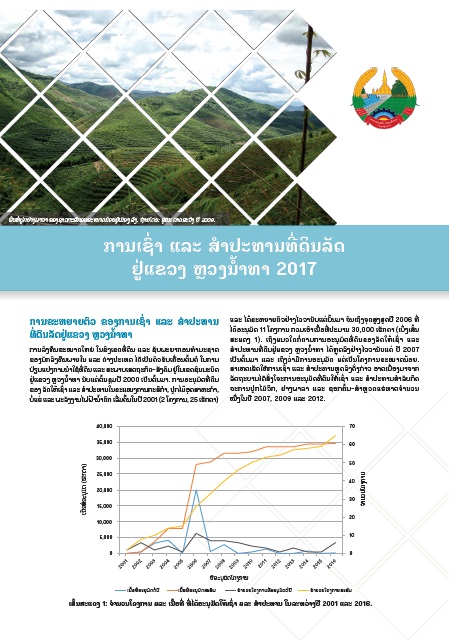
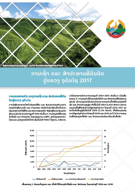
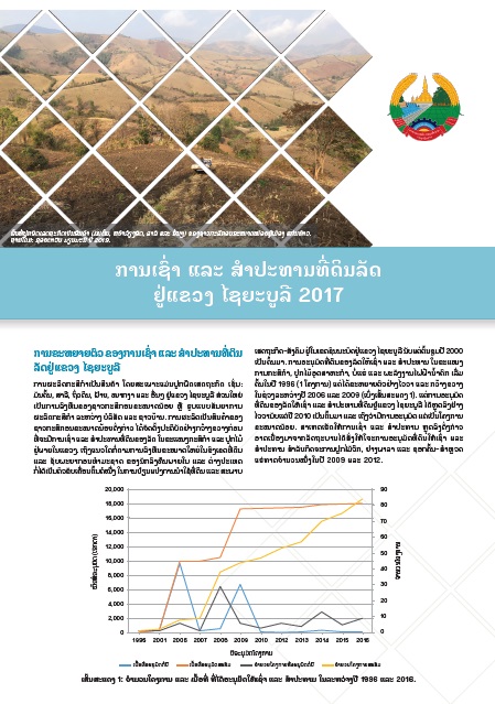
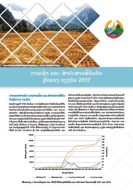
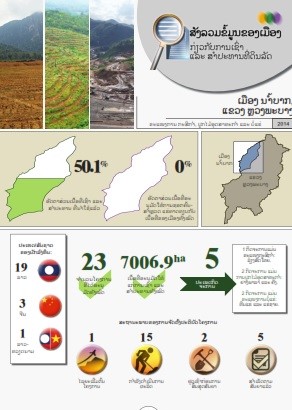
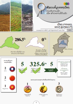
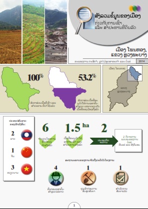
The fact sheets present key results of the national land lease and concession inventory of 2016 – 2017 by province. For the provinces of Attapeu, Sekong, Saravan, Savannakhet, Khammouan, Vientiane, Xieng Khaoung, Luang Prabang and Oudomxai, the key results of an assessment of the quality of investments are also included.
The provincial fact sheets present key results of the national land lease and concession inventory in the period of 2016 – 2017. Currently available in Lao language only.
![]() | ![]() | ![]() | ![]() |
![]() | ![]() | ![]() | ![]() |
![]() | ![]() | ![]() | ![]() |
![]() | ![]() | ![]() | ![]() |
![]() | ![]() |
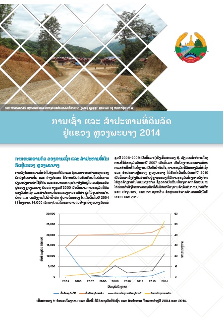
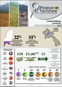
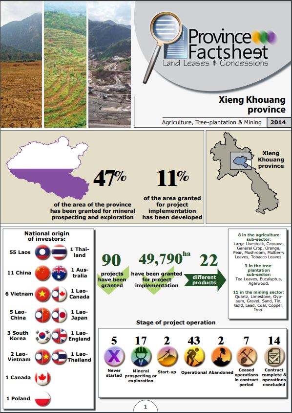
The provincial fact sheets for Luang Prabang and Xieng Khouang provinces are based on the results of the pilot phase of land lease and concession inventory conducted in 2014. The provincial fact sheets are available in both Lao and English versions; the district fact sheets are available in Lao language only.
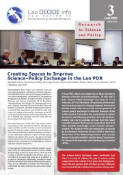
In Lao PDR, efforts are underway to foster exchange between scientists and policymakers. To this end, a first “Science–Policy Exchange” was held on 13-14 February 2014 in Vientiane. The purpose of the event was to create a space for dialogue between the various parties, and to take stock of the current practices of science–policy exchange in different thematic fields in the country. Concretely, the event aimed to obtain answers to the following questions: how can decision-makers tap new knowledge derived from the latest scientific research? And how can researchers best feed their scientific knowledge to the relevant decision-makers? The Science–Policy Exchange was co-hosted by the National University of Laos (NUOL), the Policy Think Tank of the National Agriculture and Forestry Research Institute (NAFRI), and the Swiss Commission for Research Partnerships with Developing Countries (KFPE).
Download full document
In the last decade, investment in land has boomed in the Lao PDR. This is grounded in the belief that land is currently underutilized, and that such investment can help develop infrastructure, contribute to poverty alleviation and boost productivity. But there is a lack of systematic, publicly available information about land concessions and leases on which to base analysis, debate, and action. This policy brief summarizes the results of the first national inventory of land concessions and leases. The inventory was conducted between 2007 and 2011 by the Government of Laos, with support from BMZ/GIZ. The data were analysed by CDE with support from Swiss Development Cooperation (SDC).
Download full document
Funds for poverty reduction are limited, so allocating them effectively is important in development planning. A common way to do this is to plot the distribution of poor people on maps, and then to target poverty-alleviation efforts at areas with the largest incidences of poverty. But this is a crude approach that risks missing a large share of the poor. This issue of Research Evidence for Policy shows how careful analysis of detailed spatial information can reveal patterns that are not immediately obvious. That can lead to better, more precise targeting well beyond a purely geographic focus on poor areas, and to more differentiated and spatially integrated development planning.
Download full document
These posters present the spatial patterns of a selection of thematic variables from the Population and Housing Census 2015, along with spatial patterns of changes in those indicators since the Population and Housing Census of 2005.
– Demographic dependency
– Education net enrolment rates
– Literacy
– Poverty
– Electricity
– Sanitation
– Agro-ecological region and Ethnicity
Report on the results of the Population and Housing Census 2015
These posters present spatial patterns of village-level infrastructure and population from the Population and Housing Census 2015, along with spatial patterns of changes in those indicators since the Population and Housing Census of 2005.
– Population distribution
– Schools
– Health facility
– Electrification
– Water supply
– Markets
– Road access
Provisional report on preliminary results of the Population and Housing Census 2015